 |
| South Carolina Department of Archives and History |
| National Register Properties in South Carolina McMeekin Rock Shelter, Fairfield County (Restricted Site) |
| |
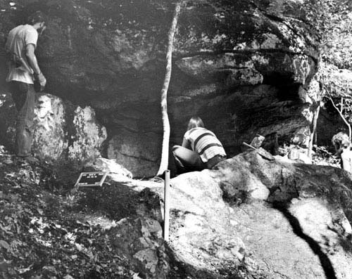
The McMeekin Rock Shelter is significant in that it provides information about poorly known aspects of both culture - history and past lifeways during the late prehistoric period on the Carolina Piedmont. The McMeekin Rock Shelter is formed by a granite outcrop of the south bank of a small tributary drainage of Frees Creek. The overhang of the outcrop is roughly one meter above present ground surface and shelters about 10 square meters of surface area. The sheltered area is less than two meters in horizontal depth. Evidence of human occupation of the site is found in the humic soil levels and at the top of the lower alluvial sand deposit. In addition, two of the upper levels contain informal hearths and pieces of burned bone. Taking into account stylistic similarities within the area, it is suggested that a number of short-term occupations occurred at the site from ca. A.D. 1200 to ca. A.D. 1400. Listed in the National Register August 23, 1974.
View the complete text of the nomination form for this National Register property.
Most National Register properties are privately owned and are not open to the public. The privacy of owners should be respected. Not all properties retain the same integrity as when originally documented and listed in the National Register due to changes and modifications over time.
Images and texts on these pages are intended for research or educational use. Please read our statement on use and reproduction for further information on how to obtain a photocopy or how to cite an item.
Images provided by the South Carolina Department of Archives and History.